Fri 5th September A worrying day

This morning – a catastrophe that almost precipitated our immediate return home…

I needed to drive the 2km back down the Aire/beach road back to the entrance where the motorhome service points are in order to drain & refill the water tanks, empty & clean the loo cassette. After waiting for my turn, I did all the necessaries, though did start wondering why it seemed to be taking so long to fill the fresh water tank. After a short while, I became aware of water running from the underside of the van. Hot water, that is. Our water heater/combi boiler was dumping water from the system.

The boiler – clever thing that it is – has a frost-prevention device installed: If the temperature drops below 4 degrees, it dumps the water. It being well over 23 degrees, this shouldn’t have been happening. After a quick panic, I found the heater’s temp sensor (buried under the floor, tucked-away in a slightly inaccessible location, and pulled the switch back out. The place we bought the van had suggested that; just possibly, if you go over a big bump, that could cause the sensor to dump water. Well, the road back was very bumpy, so perhaps that was it?

As the water had been dumped, I thought I’d run some water through the taps just to flush any air out of the system Next problem – taps not working/pump not running. It was at this point, I noticed that the van’s internal electrical system was off. Switching it on at the control panel had zero effect. No electricity = no fridge (no way to ignite the gas burner for it); no water; no loo flush; no ability to charge the phones. Very serious.

Still at the service point and holding up the queue, I tried starting the engine. No problem. Switched on the internal electrics, and on it came. Phew. Carried on filling the water tank and switched engine off. Next thing, water is draining from the boiler again, and all the power is off.

Drastic measures: Fixed a clothes peg around the frost protection switch to hold it in position.  Started engine to give me internal power and stop the water draining. Filled the tank and drove back to where Joy was waiting, patiently reserving our place. Parked-up, switched off the engine, and watched the battery voltage monitor show an absurd 15.5V battery voltage (should never go above 14V), rapidly decay to 7V at which point the system shuts down, including the battery monitor! I should mention, this is the NOT the battery for the engine, but is an additional “leisure” battery to allow use of electrical equipment when the engine is not running. Like the water pump, lights, loo, etc.

I started digging around in the (almost inaccessible) cupboard where the leisure battery resides. There’s also a myriad of electronic gubbins in there for split battery charge control (main battery or mains hookup), and for additional circuit protection (fuses) when running from mains or battery. I started tugging at cables in case something was loose. I got the instruction book out for the split charge electronics box: The LED’s were indicating no battery output. So the battery’s died? That was our thinking.

Time for a cup of tea & some breakfast, contemplating how we might get it repaired: We’re a million miles from any garage, French isn’t one of our fluencies and it’s coming up weekend when everything closes. I was on the verge of calling our insurance company to see if they could offer any help, but decided to take another look.

It was then that I noticed the main –ve cable from the battery had a broken crimp at the battery terminal. This was most definitely the cause, but didn’t help our situation. I didn’t bring any electrical tools, cables or other bits with me as I would have needed to pull a trailer for all of it. If only I could find a few scraps of cable I could bind together, I could duck tape them to the end of the main cable & to the battery terminal.  This would have been a serious bodge and – if it were to come loose – would start arcing & sparking and possibly worse.

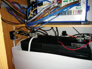
The battery negative cable with broken crimp
The battery and electronic controller compartment with makeshift negative cable

I do have a toolkit – for keeping the bikes in fettle. So I have cutters, screwdrivers, and even a ¼” drive socket set. I also had a spare stainless steel brake cable that I thought I might be able to do something with, when Joy suggested our steel-cored washing line. She then noticed an extension lead I’d knocked-up to go from UK plug to European socket. Never mind the ends, it was a piece of 13A cable. If I could use all three cores in parallel, that would serve 40A more or less, which ought to be enough capacity without danger of frying the cable. Better still, I had the right sized sockets in my socket set to get the battery terminals off.

So, 1 hour later, we have a new temporary cable made up, securely fastened at both ends and were able to get the power back on. And it’s safe.

You cannot believe how worried I was and what a relief it was to get it working again.

On an entirely different note, the wind almost blew enough today to get the board out – that seemingly useless piece of baggage that we’ve trundled all over Europe. One guy was out, but he’d a much larger sail, much larger board, and much smaller body than I; each of which is to his advantage. He also wasn’t going anywhere too fast and soon gave up. The wind forecast is still tantalizingly close to what I need. Let’s see what happens…
Thur 4th September – Saintes Maries de la Mer

It’s a funny thing: at first, I didn’t really like it here in Saintes Maries de la Mer. It can be seen to be a God-awful, smelly, mosquito-infested town at the end of the universe – all of which is pretty accurate. But there’s something about it that grows on you. Firstly, there’s the fact that it’s much warmer – nay hotter – here: we went from 16 degrees in Chamrousse to 30 degrees here. Very pleasant indeed. On more remote parts of the beach, clothes are merely optional.

Speaking of the beach: I used to think that Sotavento beach in Fuerteventura was big. At some 17km long (their tourist information claims 22km but they’re lying), it was the biggest, most wonderful beach I’ve ever seen. Still is. Fabulous white/golden sand the whole way. But it’s very windy, too – it’s a place I used to do a lot of windsurfing, and the Sotavento sand – like all the sand on Fuerteventura – is very fine. Anything more than a gentle breeze (Force 4 Beaufort) means the sand starts to blow. Frequently, it was blowing force 6, and the sand was streaming across the beach, reaching places where you didn’t know you had places. For soaking-up the sun, it was useless: two minutes after coating yourself in sun-goo and lying down on the towel you’d spent so long nailing into place, you were a sticky sandman. I used to spend endless hours in the evenings trying to dig sand out from my earholes. But we loved it there because it was so wild and so undeveloped.

The beach here stretches some 32km from Saintes Maries de la Mer on le Petit Rhone to Plage de Piémanson, world’s end, at the Eastern end, up against le Grand Rhone. Much of it is fairly inaccessible as there are no roads behind the beach, so it’s only busy close to where traffic can reach. Much of it also falls within a nature reserve, so you’re not supposed to leave the dyke (useable by walkers and cyclists) that runs inland of 14km of the beach to access the beach, except at certain allowed points. And then, it’s another 5km of cycling (on very flat paths/dykes, it has to be said) from the main dyke to the beach.

Like Fuerte, the sand here is very fine. Like Fuerte, the wind here can blow pretty hard. It did exactly that for the first two days we were here whilst staying in the campsite. Just like in Fuerte, we were digging sand out of places it didn’t ought to go, and the van has taken on a very gritty feel to it. Every surface is coated in sand and dust. It doesn’t matter how much housekeeping we do, just opening a window brings in more dust (and mozzies).

The famous Mistral wind blows all the way down the Rhone valley from the mountains, exiting land over the Camargue. It’s a cold, Northerly wind and is usually very strong, and very predictable in strength and frequency of occurrence.

There’s a particular branch of windsurfing that’s all about speed, and breaking world speed records. It demands vey specialized equipment, a lot of patience (for when the predictable winds fail to blow), and very, very specialized locations. In order for a speed to be ratified as a record, it must be measured over a (minimum) 500m course in the presence of official observers. The course must be wave-free. Waves slow down windsurf boards so locations without waves must be chosen for speed record attempts. Sotavento is used every year despite being coastal: The course is set within 2 metres of the beach so the offshore wind has no chance of creating waves in that space. Of course, the ocean-generated waves still come in towards the shore so it’s far from ideal, and the whole circus is more of a publicity/financial affair. Ideally, the course should be set at 120 degrees to the wind: that’s the angle that most craft can attain the maximum speeds. Sotavento beach is pretty close to that 120 degrees, purely by chance.

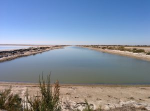
Back in the 1990’s, some famous windsurfer noticed the reliable winds here in the Camargue and decided it would be a good place to build a purpose-built speed course. Permission was duly obtained, and a 1km long ditch, 20 m wide, 120 degrees off the typical Mistral wind direction, was built on the beach just to the East of Saintes Maries de la Mer (the “Canal”). Every year, the windsurfing speed tour would come here and – most years – records were broken; the last ones here being in 2005.

Things come and go. The cost of upkeep of the canal at Sts Maries was high, the wind failed to blow for a few successive years, and other, better locations were found (in Namibia). The “canal vitesse du surf” has not been used for many years now, but it’s still here. Forlorn, slowly filling-in with sand and salt, it’s now the province of gulls, little egrets, herons, fish, dog walkers and mosquitoes. I really wouldn’t want to let any part of my body come into contact with the water remaining in there. But it’s a piece of windsurfing history, and I walked the length of it just for pleasure of being there. If you’re interested, you can still see it on Google Earth. It shows quite clearly as a dark, straight line, between the dyke and the sea, about 3km to the East of the town. Apparently, it does fill up with water when Autumnal storms coincide with spring tides.

The speed canal

The Camargue is all marsh. They (the French) like to call them “étangs”. Alistair Mclean once wrote a book (one of his very early novels) called “Caravan to Vaccarès”. Well, Vaccarès is the biggest étang in the Camargue. But actually it’s all marsh. In the summer, most of these étangs dry out, leaving a crusty layer of shimmering salt. And mud. Lots of slimy, smelly mud. And innumerable flamingos. But besides this, we see herons, little egrets, oystercatchers, curlews and more varieties of gulls than I knew existed.

I may have mentioned the beaches? Today, we cycled 14km along the dyke to the Phare de la Gochelle (Phare = Lighthouse). We then took another dyke S to the beach. There were a dozen or so cars or camper vans parked adjacent to the beach. As the sand near the top of the beach was very dry and had a salty crust on it (obviously no tides have been up here for many months), it made for easy cycling. Less than 1km along, and the whole beach was ours. One couple about 300m to one side of us and that was it. And it wasn’t windy, and the sand wasn’t blowing. It wasn’t too hot (26 degrees, apparently) and there wasn’t a cloud to sully the sky.

Busy beaches

You may have heard of the Camargue horses? I don’t know the history, but the Camargue is very tied-up with horses through its history. White horses, they are. Many of them roam freely over the marshy land. Many more of them are available to rent by the hour.

Yesterday, we were on a not-quite-so-remote-piece-of-beach-as-we-were-on-today. At around 6pm, some five or six horses were brought along the beach at a fair old gallop by their riders (all young girls), who decided to them take them into the sea right beside us. They were clearly used to the sea, and had a rare old time pawing at it, cantering through it, galloping along the beach beside it for the sake of one of the girls recording it on her iPad, and generally getting thoroughly wet. Great to watch such accomplished riders on such fearless horses.

Not galloping down the streets, but far easier on their hooves, I would think.
Sea horses?

I really think I like this place.

Sun/Wed – 31st Aug/3rd September

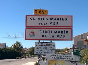
Err – what the sign says

We find ourselves in Saintes Maries de La Mer, in the hot, sunny Camargue. I don’t quite know what to say about it, really!

We’ve never been to the Camargue before; it’s on the South/Mediterranean coast of France; it has beaches; it’s supposed to be windy (there used to be a windsurfing speed channel at Saintes Maries de la Mer where the world windsurfing speed record was broken in 2005); and we wanted to head South, so it seemed to be a suitable choice. It has a couple of campsites and a couple of aires, and the holiday season is just about over, making the choice more reasonable.

The Camargue itself is the flat marshy delta where the Rhone meets the Med. It has Hispanic links (though I’m not sure of the origins of these) and is famous for Romany gypsies, and white horses that seem to roam freely over the area, as well as being used for equestrian recreation (as could be well assumed by the clear evidence of their passage just about everywhere).

In summary, the words that come to mind are dust; drains; dragonflies and flamingos. After 24 hours here, there is a not-so-fine layer of dust over everything inside the van. When we arrived, there was a gently breeze that petered-out in the evening. In the night, the van started rocking and I had to wind the awning in as the wind was really working itself into a frenzy. I wanted wind for windsurfing, but the wind we had was crazy. It was also blowing dead offshore. This is the famous Mistral wind that blows from the mountains down the Rhone valley, over the Camargue and out to sea. Because of limited space, I brought my middle-sized windsurfing board with me, plus just two sails: this should cover me from force 4 to force 6 ish. We had force 6 to 8. With this strength and direction, there was no way I was going to risk life, limb and equipment.

Despite all the lakes (étangs) around here, this is a very arid spot. Many of the étangs are presently nothing more than somewhat smelly saltings right now. So the area is dusty. Actually, very dusty. In fact, the dust is sand; it’s very fine sand and it takes very little to make if blow into spindrifts. The rug we placed outside our doorstep got buried overnight and – despite trying to keep the flyscreens over the windows – we cannot keep the dust out. It’s got everywhere. We’ve given up trying to keep it out – though today, the wind seems to be moderating [incidentally, the wind forecast for the next several days is… none at all. Bummer.]

The étangs are home to flocks of flamingos. There are thousands of them here. If I remember correctly from visits to Slimbridge bird sanctuary, I recall them being particularly smelly creatures. That recollection seems to be confirmed here. The smell is overpowering.

To be fair to the flamingos, I don’t think I can lay all the smelly blame on them. The drains around the campsite are something else, and the wind seems not to help keep the smell at bay. I did notice a complete absence of U-bends/bottle traps on the washbasins, so we’re living with different standards here. Similarly, I have completely failed to detect any sewage treatment works which makes me also not too keen to get in the sea just here.

There’s a dyke that runs behind the beach between Stes Maries and Beauduc, further to the East. We cycled about 5 km E along this dyke and onto the beach there. We were about the only people there. It was fantastic. The sea, however, is cold. Far too cold for anything other than swiftly cooling off.

Dragonflies are everywhere. They are huge, fabulous, flapping giants that accompany you everywhere. I can see a dozen or so outside the van right now – though they’re struggling with the wind, too.

We ate out on Mon night. It wasn’t easy as most of the restaurants were closed. Day off, or closed for the end of season? Most restaurants major heavily on fish, shellfish and “tareau” (beef, as in the Spanish “Toro”, or bull; bullfighting being a part of the way of life in the Camargue). We eventually found a restaurant that suited both of us. The service was surly at best, the prices – whilst lower than many other restaurants – was still slightly eye-watering, the steak was tough.

Today, we’re going to up-sticks from the campsite and camp up along the seashore. When we arrived, there were camper vans parked in the official aire outside the campsite, and along the track at the top of the beach. I’ve never seen so many mobile homes – they seemed to stretch into the distance. We’ve cycled alongside and seen there are still vacant spots: Let’s see if we can grab one. There’ll be no more Internet connection for a while, though! I’ll try to upload some photos next time I have a decent connection – possibly back in the UK 🙁

Sat 30th – Sun 31st Aug. – Fontaine de Vaucluse

We’ve taken a branch off our main road to head for an aire that seemed off the beaten track, therefore less busy, therefore get a decent night’s sleep after last night in Sisteron.

This is a tiny little town called Fontaine de Vaucluse, and it has an aire for about 30 motorhomes. It also has the most complex entry/pay/security system we’ve ever come across. We joined the small queue of vans waiting to get in; the hold up being people unable to get the entry machine to do their bidding and make the barrier go up. We did eventually manage to get in, though we never got the “gratuit” Internet access that was allegedly available.

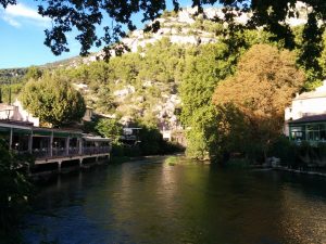
Another fabulous and interesting town. There’s a river through the town that’s absolutely crystal clear. It’s probably the clearest river I’ve ever seen. It’s not a small river – probably 20 m across, yet it rises from the foot of the cliffs 300m upstream of the town. It’s apparently the largest spring in the whole of Europe. And it doesn’t end there. There’s a footpath that runs alongside the river/cascade, past the main spring(s), and leads you to a cave at the foot of the cliffs. You can’t really get into the cave as it’s more like a vertical hole. And it’s full of water. Just a still water surface. A couple of times a year, the water level in the cave rises. And rises, and rises. By some 20 m or so. It then overflows from the cave and cascades down to join the rest of the river. This is – it is said – an awe-inspiring sight.

The Vaucluse
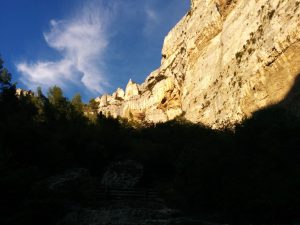
The Vaucluse rises from a cave at the bottom of this cliff

The cave itself has been explored many times; the first dive taking place in 1853, from which it was established that the floor of the cave was 24m down. The next dive established a floor at 32m down. Subsequent dives over the years have explored further and further down, the most recent in depth being determined in 1985 as being 308m by remote control diving vehicle. Further explorations  2003 and 2004 revealed hundreds of Roman coins and other artefacts that were retrieved. The full extent of the cave system is still unknown, as is the cause of the twice yearly flooding of the cave. Fascinating.

Getting out of the aire in the morning was no easier than getting in. Especially as there were motorhomes trying to get in & thus blocking the only way out. In fact, the people trying to get in  called out the Gendarmerie as they’d paid twice and STILL the barrier wouldn’t let them in!

Needless to say, we eventually made good our exit and continued to head South – the temperature rising all the time, reaching a very pleasant 29 degrees by the time we reached our chosen destination of Saintes Maries de la Mer.

Fri 29th Aug. – Gap and Sisteron

We left Chamrousse somewhat late in the day. We’d identified a couple of Aires around Gap & Sisteron that might be useful stopovers on our way South. There is an unfortunate lack of Aires in this area so we were keeping our fingers crossed, especially as the ones we could find on ProMobile didn’t have great reviews.

The Route Napoleon runs from Vizille – South of Grenoble – down to Cannes in Provence, following an often perilously twisty course through several lumpy bits of France. We drove the entire length of it back in 1982: after a lengthy training course in Grenoble, I’d booked a holiday cottage in a miniscule village called Gigaro, about 10km to the South of St Tropez. That was in a Ford Cortina 2l Estate with loads of spare power. This time, we were only going to a point to the South of Sisteron before branching off towards the Camargue. And in a huge van with very little spare power. Slightly worrying, as the map showed the bit through Vizille as being unsuitable for large vehicles. It all worked out in the end as “large vehicles” turned out to mean over 26 tonnes. Even we don’t stretch anywhere close to that.

We reached Gap. Gap has two aires: The first one turned out to be a supermarket car park, inhabited by a large number of darkly dubious types. A quick about-turn and search for the second one. Yet again, her up the windscreen messed us around, taking us down a tiny road on exactly the wrong side of the railway line, before the road ended in a no-entry sign. I may have mentioned it before, but doing a 3-point turn in narrow roads is not our vehicle’s best selling point. Despite having a reversing camera, I managed to snap the end off our waste tank drain-pipe, clipped so conveniently to the underside when I hit the bank. Bugger.

We found the other Aire: It had 4 motorhomes in it and was full. There were two other vans seemingly queuing for a space. So we headed further South.

We reached Sisteron at about 7:30pm and found the Aire at the side of the main road. There were 4 places available, one of which was taken up by a Spanish truck. We grabbed the best space of the rest.

It wasn’t a peaceful night. We were right next to (i.e. 2 metres away) from the main road, and it was very busy. We walked into Sisteron to take a quick look and found it to be yet another of those wonderful places you could easily spend a couple of days in. The aire / car park was perched on top of the old city walls. About 30 metres vertically below us was the ancient road crossing the river, and 200 m down the road was the ancient portal (now removed) through which the old road used to pass under the cliff to reach the town.

Across the river

Wonderful old part to the town, with slightly Moorish appearance, very narrow streets, and a citadel perched high up above the town. The next morning, we went on a hunt for a boulangerie and spent some time in the market buying fruit. The market was causing havoc for the traffic through the town, and we had still to drive through the town!

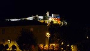
The Citadel, Sisteron

Tired, with lack of sleep we headed further South, branching off the Route Napolean at Chateau-Arnoux St-Auban.

Thur/Fri 28th/29th Aug. – Chamrousse/Sisteron

Thur 28th Aug

Thursday dawned well. We (eventually) decided we were going to walk to Lacs Roberts – over the hills and far, far away. Actually, it’s only about 5.5km away – at least, according to the signs. But most of it was fairly vertical and by the time we reached the diminutive Lac des Pourettes (only 2.5km from our start position, allegedly) we were pretty worn out and it was time for lunch. Some of the walking was fairly intense, involving clambering up (and down) steep, rocky sections of path. Neither Joy’s bad knee nor my bad knee were very appreciative of this. It was also pretty hot. After we’d had our packed lunch, we headed back.

As it was still warm, we decided to sit outside – on the terrace of one of the bars. We ordered a (biere de) pression each (draft beer). It was horrible. I asked if they had any other beers: They had and so Joy & I each ordered a different (bottled, this time) beer. This time, they were very good whilst also being very alcoholic at 5.9% and 6.3% respectively. For that little lot, we paid the handsome sum of €20. The two “special” beers (as they turned out to be) were €6 each (for a mere 33cl. Never should you expect to buy French beer cheaply in a bar. Even when the bar is in a ski resort, out of season, and is otherwise deserted.

Fri 29th.

We’re leaving today, but not before I have another ride down one of the mountain bike downhill routes. Joy elected to do the cross-country trail, so I took the tele-cabine up to the top and followed the blue trail down from there. There were a couple of sections I felt I could have done – had I been wearing more body protection; had I been closer to home; etc – but didn’t. The rest of it was good fun but would have been far better on the other bike I left at home (my full-suspension bike).

After filling the van with water, we set off down the Route Napoleon, eventually arriving at Sisteron at about tea-time. But more about that when I next have time (and an Internet connection).

More from Chamrousse

Wed 27th Aug.

Yesterday was vile. It started raining at about 04:00, and – other than a brief pause, just long enough for Joy to have a quick walk over the nearby hills – it didn’t stop until sometime in the early hours of this morning. The whole time it rained, the large skylight was leaking so we had to have the buckets and bowls out to catch the drips. To be fair, it wasn’t all that cold – probably around 16°C – but it wasn’t pleasant.

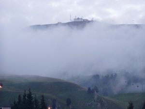
So when I woke up this morning, I could hear it was no longer raining, but I expected it to be grey and overcast. Wrong: there wasn’t a cloud in the sky. At least, not above us. The cloud was all below us, completely blanketing Grenoble and the 3 valleys that converge on Grenoble. We weren’t basking in the sun, however, as it hadn’t yet risen here (there’s a 2250m ridge to the East of where we’re parked). But I did manage to get some photos of the sun rising behind the ski station. The views were truly inspirational and make up for yesterday’s dismal performance!

The cloud below us
The sunrise above us
Grenoble must be there somewhere
The sun makes tramlines from the cable car cables

Whilst Joy was walking yesterday, she got chatting to a lady on the hills who was gathering blueberries on the mountainside. Now that the rain had stopped, it seemed like a good idea. So we took off over the hills and far, far away. Well, a couple of kilometres anyway, though much of it was vertical! We spent a couple of hours gathering the tiny berries; a bit of a labour of love as there’s not a great deal of reward for the effort. Still, between us, we managed to pick enough for a decent sized crumble, which has just gone into the oven as I speak (or write!).

Although it had been a fabulous morning, as the day progressed, it seemed as though all the cloud that was in the valleys was rising up towards us. Sometimes, we were totally engulfed in fog and shivering. The next moment, it would clear and we’d be in hot sunshine. Difficult to dress appropriately for the conditions, but scenically awe-inspiring.

The cloud rises
The highest we got today

Whilst blueberry-picking, it was impossible to take a step without several grasshoppers or crickets jumping out from under your feet. I’ve never seen such a variety of shapes, sizes and colours. As the sun warmed up, so did the crickets; their chirruping and hissing accompanying us. We each came across small frogs: olive green and perhaps 3cm long. Makes you wonder what becomes of all the wildlife during the six months of the year the ground is snow-covered?

The forecast for tomorrow is good. Really, it’s the main reason we’re staying on here – hoping for that one good day!

Chamrousse

Sun/Mon 24/25th Aug.

More years ago than I care to admit to, back in my early days as a field computer systems engineer with Hewlett Packard (HP), I spent a lot of time in Grenoble, France. HP had a engineering training centre there that covered everything about computer systems hardware, peripherals, telecoms (that used to mean RS232 in those days), and networking (yes, we had interconnected computers back in 1981, though no-one quite knew what to do about it). Some years, I’d spend enough weeks out of the country in Grenoble to allow me to claim back tax (that’s in the days when such allowances were available – sadly no more) over a tax year.

HP was a great enough company then to even pay for your family to go away with you if you were away on a long (e.g. 4 weeks) training course and opted to take your own (company) car. And so, Joy and Kathryn (pre-Oliver days!) came away to Grenoble almost as many times as I did, staying in the Hotel Alpha in Meylan – on the outskirts of the city. The Alpha used to have kitchenette apartments which we always managed to stay in, so the cost to us as a family was only marginally more than living back home.

We came to really like Grenoble (despite the fact that my car was broken into and my camera was stolen just nearby), and we had plenty of time to explore it and the environs. Grenoble is more or less right at the entrance to the French Alps. It’s in the Haute-Savoie region, and there are the vast National Parks of Ecrins; Vanoise; Chartreuse (yes, where the green stuff comes from); and the Vercors. Not to mention spitting distance to the ski resorts of Les Deux Alpes and Alpe d’Huez, and within easy reach of the Tarentaise Valley with the major resorts of Les Trois Vallees; Valmorel; La Plagne; Les Arcs; Tignes and Val d’Isere. But the very closest ski resort to Grenoble is Chamrousse, just 50 minutes drive from Meylan.

In terms of high resorts, Chamrousse isn’t one of them: The villages of Chamrousse – Le Recoin, and Roche Le Bèranger (which have recently been given the trendy names of Chamrousse 1650 and Chamrousse 1750, respectively) are at a pretty respectable altitude, though the mountains don’t really reach much above 2250m and so the skiing is consequently limited.

Chamrousse has fond memories for us from 1982’ish when we were probably last here, and so it’s long overdue a visit. There happens to be an Aire for motorhomes (only introduced in 2012), with water supply and drainage, and electricity – all for a fairly nominal fee. And so, here we are in the wonderful mountain air, with the summer holiday season just ending and very few people here. The van even made it up the steep & windy mountain road without too many complaints.

Looking down to Grenoble

It’s not all roses, however; in our planning, we completely neglected to take account of the temperature at this altitude, it having been fairly warm lower down. So last night with fog all around us, and the mercury dipping to around 7c, I realised I’d not brought any cold-weather clothes with me. Even my duvet is summer-orientated, so it was a chilly night.

The top ski station – 600m above us.

Mon 25th Aug.

Call me a wimp, but I put the heating on in the van this morning, much to Joy’s disgust. It was only 10°C indoors.

Whilst here, we’d hoped to do some mountain biking and – perhaps – some walking. I guess we’ve missed the ideal time for walking, which must be June – when all the alpine flowers are at their best. Also, the forecast isn’t brilliant: The sunny and 17°C forecast is not in evidence. It’s cold, overcast and there have been a few spots of rain. The forecast for tomorrow & Wed is heavy rain showers.

So today’s the day for all the activities. Out with the bikes, and onto the gentle “cross-country” trail that runs from Chamrousse 1650 to Chamrousse 1600 with only small vertical deviations to test our altitude fitness. The sun came out, and we stopped to take photos of the ponies at the small riding school, with snow-spattered mountains in the background.

The pony school

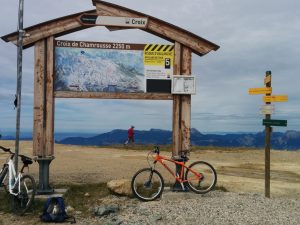
There are also a number of downhill mountain biking trails here (another reason why we’re here), ranging in difficulty from green, through blue to red, then black. Like ski piste difficulty grading, mountain bike trail grading can be every bit as inconsistent from one place to another. We took our bikes up the gondola ski lift to the top, intending to take the green run – which should be enough of a challenge for Joy.

Just off the ski lift

The map shows a blue run off the top, running along the ridge before splitting off onto red and green alternatives. We didn’t find the green trail and ended up doing the blue for the entire 1st section. Joy struggled with this, but soldiered-on. In my opinion, the blue was equivalent to red+ on the trails I’m used to, so there were some gnarly sections. Quite a few, in fact.

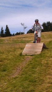
Eventually, we did find the green trail lower down. It was no easier than the blue we’d already done. Fun for me, but hard on Joy. We did get down without any incidents and lived to tell the tale.

A fun little ramp

Internet access is no easier in France than it was in Germany. Worse still, my phone now seems to be playing-up and switching-off the phone signal so I can’t make/receive calls/text messages. I have to keep rebooting it to overcome the problem. However, the Tourist Information office here has a fantastic, free WiFi point. All I need now is to find some time to park myself in the building to do everything I need to do. These last several blog updates come to you courtesy of Chamrousse TI.

Mishaps and Dole

Fri 22nd Aug.

A morning of mishaps. A later-than-hoped-for departure from the campsite in Ihringen preceded a drive into town to a supermarket to stock up on essentials (German beer, primarily. But this is a wine region and the beer selection was poor.).

On the way into Ihringen is a petrol station that also sells LPG/Autogas (we have a refillable LPG gas system on the van so we needn’t worry about swapping gas cylinders, which is actually very difficult when crossing country borders as a gas cylinder from one country can’t be swapped/refilled in a different country). The LPG pump displayed a very large notice to the effect that it was illegal to use LPG for anything other than driving the engine. Hmm. I’d heard rumours about this but this was the first time I’d come across it. So we decided to be good citizens and not fill-up our tank here. Less good in the citizenship stakes was that I managed to remove part of the roof over the LPG pump whilst driving away as the overhanging back-end of the van swung out and caught it amidships with a loud cracking sound. Fortunately the van is undamaged other than a few scratches on the awning caused by breaking polycarbonate roof panels. To be fair, the lady in the petrol station was very matter-of-fact about it as we swapped insurance details, and even said she hoped that was the worst thing that would happen to us today. It was. Just.

In the supermarket (as in almost all German supermarkets), there’s a machine for returning your empty plastic bottles, and another for returning your empty beer bottles. Both machines issue credit slips for the refunds on the bottles. These credit slips can be cashed-in at the check-out (smart machines, they have a laser scanner inside them that scans the barcode on the labels, accepting bottles that are recognised, and declining refunds for bottles that aren’t recognised (like the Italian water bottles we’d been toting around, trying to find somewhere to recycle them!). Needless to say, one of the beer bottles failed to make it into the machine and proved no match for the concrete floor it fell upon. Fortunately, we weren’t lacerated by broken shards, and a very nice lady came and cleared away the mess.

With our tails metaphorically between our legs, we hot-footed it out of Germany and into France following guidance from “her on the windscreen”. To be honest, we had no clear idea of where we were heading. “South” was the general idea, but do we go to the Med coast, or to the Atlantic coast? And so undecided, we agreed to head for a place that was close to the “watershed” in terms of road directions: a place from which we could choose either direction. A place I’d never heard of before except as a sticker on the skin of a banana: Dole.

And so we rocked-up in Dole having driven through some beautiful countryside (“she”’s been programmed to keep us off toll roads. i.e. 99.9% of all motorways, and so we’re sticking to the main roads, most of which are really good). Much of the route was alongside the river Doubs. We parked-up at the aire along with about 20 or so other motorhomes. No facilities, but completely free of charge.

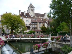
Pretty as a picture

The aire was situated between the river Doubs and the Rhine-Rhone canal, which – in Dole – formed part of the town’s defences in earlier times. It was also next to the Stade de Sport. We’d arrived just in time to see two teams coming out of the sports hall changing rooms – each team dressed in their own team colours – and make their ways 10 metres or so onto the car park which also turned out to be a boules piste. Yes – they wear team colours here for boules matches (Pat & Gaynor take note!).

Unfortunately, the aire was also adjoining a fairly busy road that continued to be used throughout the night. A bit noisy, but not too bad. At least not until an emergency vehicle went past with alarm going.  I didn’t sleep too well.

Sat23rd Aug

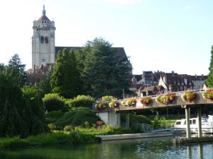
This morning, I wandered up into the town to find a boulangerie for an obligatory roof-of-the-mouth-shredding baguette, a croissant and a pain aux chocolat. It was a steep climb up – what I realised to be – a very ancient street. There was a hotel that used to be the town mill on a branch of the river diverted into the lower town in the 13th century. But there wasn’t a boulangerie, neither ancient nor modern. At the top of the town is the most imposing church of Notre Dame – and enormous church, originally from the 16th century and rebuilt many times – the last restoration being between 2002 and 2005. Eventually, I managed to procure the required baked items & returned for breakfast.

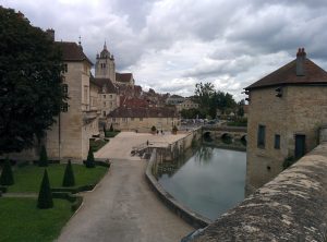
The Notre Dame church towering above yet another “Little Venice”
The inner “river”

After breakfast (i.e. practically lunchtime) we decided we’d both explore the town in some more detail. I don’t know how we do it, but almost every place we happen to stop in is fabulous in some way. In addition to the church, Louis Pasteur was born here – the house of his birth (a tannery) is now a museum. The town used to be the principal town of Bourgogne for many centuries. It’s a beautiful and famous town, and I’d never even heard of it.

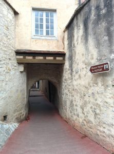
To Louis Pasteur’s birthplace

Destination programmed in – somewhere North of Bourg-En-Bresse. We’ve decided to head down to the Med. However, we have decided to take a detour off into the alps en-route and we found a convenient Camping Municipale in St Etienne – just to the N of Bourg-En-Bresse – in which to pass the night.

Arrived at our daughter’s house

We’re in Germany. Ehningen, to be precise.

Two days without any internet connection and I feel like I’ve been cast adrift. What were those days like before the Internet? I guess I’ve been in the IT industry so long, I can’t remember. We even had company-wide internal email in HP in 1983. Now, If it feels completely unnatural not to have permanent, wireless access.

Arrived in Calais around 2:15am, local time. We never intended to get the late ferry but – without having booked the early ferry (believing we could just rock up & pay at the gate) – we found the price of the earlier ferries had gone up from £43 to £105. So we booked the late ferry at £43 still.

We spent out first night away in the stunningly exotic location of Calais docks departure area. We’d read that it was possible to park up there overnight, the trick being to leave the arrivals area, drive out of the docks to the 1st roundabout, then double back to the departures where you could park up in a motorhome. Ok, so we were tired; we managed to get into the freight terminal amongst several hundred trucks from Rumania, Poland, Latvia, & goodness knows where else. We were politely shown the  exit – the gate of which slid open majestically to allow us through to the outside world. A second stab at it saw us successfully entering the “departures with no tickets” area, complete with large car park sectioned-off for cars, motorhomes, buses, hang gliders, rubber dinghies, illegal immigrants, etc. It was almost full. We managed to park our beast in a slot designed for a Smart car, adjacent to an old, UK-licensed Astra with blacked-out windows and completely flat tyres, that clearly hadn’t been parked-up there anytime recently.

In the morning, we thought it would be nice to drive to an “aire” a few miles out of Calais, towards Dunkirk. We’d bought ourselves a guide book to all the French aires, and the one we selected sounded like a great place for breakfast. We’ll never know. We never found it. I think we covered 50% of the N of France coastline but had to give up in the end.

So we chose another one from the book, a little further along the route. We found the town. We even found the street, but we couldn’t find the aire – nor the cemetery it was allegedly next to – until our 3rd pass. Excellent. We even managed to find a friendly artisanal boulangerie close by.

By lunchtime, we hit the road proper: Lille, Namur, and a whole string of other places until we arrived at our next chosen aire at Longwy. In France, but we’d gone in & out of Belgium & Luxembourg several times in the 30 mins before arriving. With a name like that, it could have been in Wales.

I can’t figure out what drives the French to offer these aires. To cynical Brits, it seems odd that French local communities should go out of their way to provide (usually) free parking, often with water, electrical hookup, and chemical toilet emptying facilities. What’s in it for them? Many of these aires seem to be in provincial towns of little touristic interest, so I don’t really get it. Don’t get me wrong; I think they’re a fabulous institution, and maybe they are run out of true altruism for the traveller. But in the UK, they’d be barricaded, there’d be height barriers, £20 overnight parking fees & the threat of clamping for non-compliance. Which would you prefer?

Today, we drove again in & out of France, Belgium & Luxembourg for a while (Note: Luxembourg is THE place for less expensive diesel fuel. We even came across a bizarre section of road where – on one side of the road were – quite literally – ten or eleven gas stations next to each other. On one side of the road only. That side of the road was in Luxembourg, the gas station-free side was in Belgium.)  before crossing into the land of speed-unrestricted motorways.

I’ve said this before of Germany: The fact that large stretches of Autobahn have no speed limits is – of itself – no great safety problem in my mind as long as all the traffic is doing more-or less the same speed. The trouble comes when you have a string of BMWs, Mercs, Audis, Porches, VWs all doing over (say) 160km/hr (around 100mph), when a truck (or even a ponderous motorhome like ours) doing 60km/hr going uphill pulls out to overtake another truck doing 59km/hr. That’s a closing speed of 100kph (or 60mph). And the thing is, those fast cars weren’t even in your rearview mirror when you pulled out. It’s the speed differential that’s the problem. Although some idiot is always going to try sending a text message whilst doing 180. That can be a problem too.

We have to allow ourselves an extra 25% on our SatNav’s anticipated journey times: Garmin haven’t yet figured that some vehicles just can’t do their calculated avg. speeds.

Our daughter’s house is on a teeny-weeny cul-de-sac, 6 houses long, and about 3.4m wide. Our van is 2.3m wide. There’s nowhere to turn even a Smart car around in the street. The only way is to reverse in; a worrying time for the neighbours’ walls and gardens. Made it without any known damage to vehicle or property. Whew.

Lovely to see our family & grand-children again.